

- cross-posted to:
- osm@feddit.uk
- cross-posted to:
- osm@feddit.uk
From the weekly newsletter:
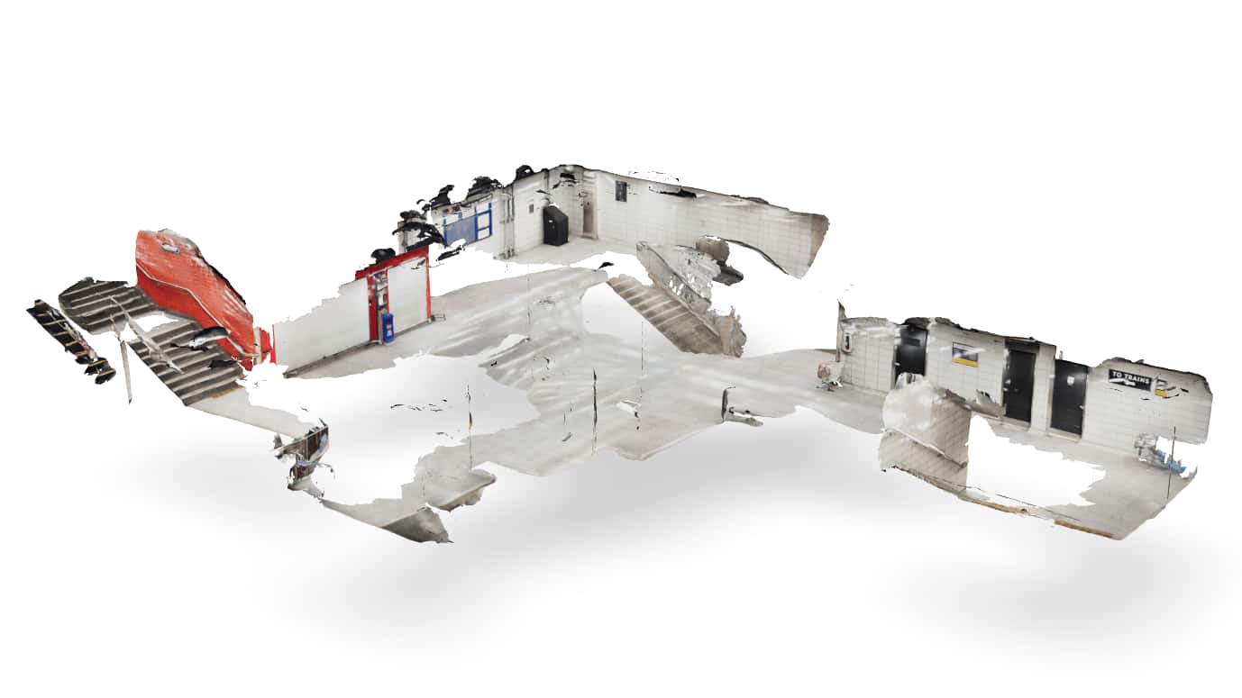
Henry Wilkinson has mapped the Dundas West Station in Toronto, Canada, using the LiDAR sensor on an iPhone 17 Pro, in combination with the Niantic Scaniverse app, to capture 3D data. He then reconstructed the digital 3D scene with Meshroom and Blender before uploading the results to OpenStreetMap through JOSM (using the PicLayer plugin) to align imagery, and iD for streamlined indoor tagging. The completed work enabled detailed indoor mapping of the station, now viewable on OpenLevelUp.
First paragraph from the article:
Despite having a passion for technology, I generally upgrade my phone every 6 years or so. One of the features I have been most excited about this time around is the LIDAR sensor on the iPhone 17 Pro. After some initial success using Niantic’s free Scanniverse app to help make furniture decisions while apartment hunting, I decided to have a go at using it to capture some information to feed OpenStreetMap, my favourite open-data obsession.
You must log in or register to comment.
If you want to see this work rendered, you can check it out using OpenLevelUp!
Thanks!